Features
Mapping
Research
Mapping ground water from the air to ensure sustainability in California
June 1, 2017 By Stanford University
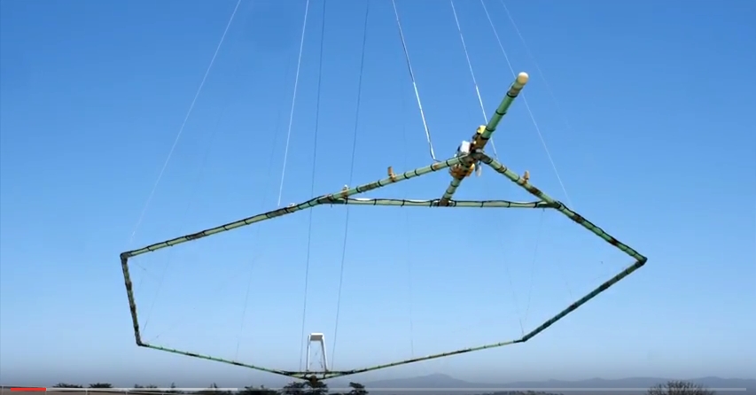
California – Stanford Earth’s Rosemary Knight recently spearheaded a project to map underground freshwater resources and forecast the intrusion of saltwater into aquifers beneath the California coastal town of Marina.
The project, a collaboration between Stanford, the Marina Coastal Water District, and Aqua Geo Frameworks, involved a low-flying helicopter towing a giant, instrument-laden fibreglass hoop that generated ground-probing magnetic fields that penetrated 1,000 feet beneath the surface.
Advertisement
Print this page
Advertisement
Stories continue below
Related
Tags