Features
Research
Strategies & Innovations
Down-hole camera footage reveals water-well secrets
August 8, 2020 By Kristin Pearthree
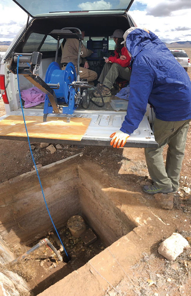 From left: Bureau hydrogeology technicians Scott Christenson, Kitty Pokorny and Trevor Kludt monitor the camera feed from a well. Photo: New Mexico Bureau of Geology and Mineral Resources
 The New Mexico Bureau of Geology and Mineral Resources’ Aquifer Mapping Program has been collecting down-hole camera footage of the insides of water wells across the state. The footage will fill in information about the wells’ internal
structures and can help interpret aquifer level changes.
The statewide Collaborative Groundwater Monitoring Network tracks water levels in participating wells, particularly targeting rural and under-monitored areas. A selection of these data collected by the state network is shared to the United States Geological Survey’s (USGS) National Groundwater Monitoring Network.
Ground water level data are used to monitor how much water is in a well, which represents conditions in the local or regional aquifer. These data can be used to track water level trends over time, make water use decisions, protect and manage a well’s associated water source, and identify faulty equipment and leaks.
“For a well to be included in the USGS National Groundwater Monitoring Network, certain details must be known,” says Bureau Aquifer Mapping Program Manager Laila Sturgis. “This includes the total depth of the well, the depths of the screened intervals and the casing material. With some older wells this information has been lost over time or needs to be updated due to well repairs.”
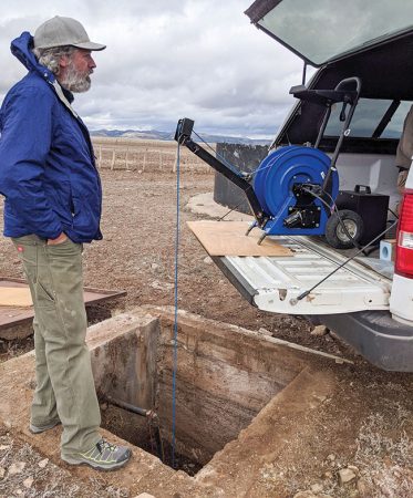
Bureau geohydrological lab associate Trevor Kludt watches as the camera is lowered into a well. Photo: New Mexico Bureau of Geology and Mineral Resources
This is where the new well camera footage comes in. The Bureau has been using specialized well cameras to inspect several wells this year and describe their internal structures.
Recently, Bureau technicians surveyed one of the deepest wells in the network using a camera that is capable of reaching a depth of 1,000 feet. The camera housing and cables are quite robust for these deeper wells, so a smaller-diameter camera will be used to view shallower wells.
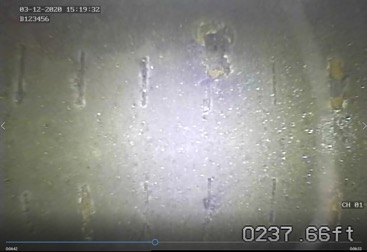
Small (about 0.2 feet in length) slots in a well screen (side-view camera). Photo: New Mexico Bureau of Geology and Mineral Resources
The camera footage also supports interpretation of water level changes within wells. Wells can penetrate more than one aquifer. The camera footage can provide information to help hydrogeologists interpret which aquifer the well is screened over and, therefore, which aquifer is the source of water. Identifying which aquifer is the source of water is crucial for tying changes in water level to changes in pumping, land use, precipitation or recharge.
The Collaborative Groundwater Monitoring Network is funded by the Aquifer Mapping Program and by the Healy Foundation. As part of the USGS National Groundwater Monitoring Network, through a co-operative agreement, funding has been provided to share data and collect well camera footage.
THE BUREAU’S ACTIVE PROJECTS
Regional
- Salt Basin, regional hydrology study
- Mimbres Basin, regional hydrology study
- Plains of San Agustin, regional hydrology study
- Animas River, Gold King mine spill monitoring
- Snowy River, Ft. Stanton cave hydrology
- Rio Rancho, ground water data compilation and geologic mapping
- Tiffany Fire Watershed Restoration
- La Cienega, regional hydrology
Statewide
- Water Data Act
- Collaborative Groundwater Monitoring Network
- 3D Aquifer Mapping and Visualizations
- USGS National Groundwater Monitoring Program
Kristin Pearthree is a Research Scientist with the New Mexico Bureau of Geology & Mineral Resources at the New Mexico Institute of Mining & Technology in Socorro, N.M.
Print this page